Wednesday, June 11, 2008

Day 11, West Wendover to Salt Lake City

I guess the sacrifice that we made of a small furry animal at the alter of the bike repair stand several days ago to the weather gods paid off today**. For a second day in a row, we had strong winds coming out of the west today.

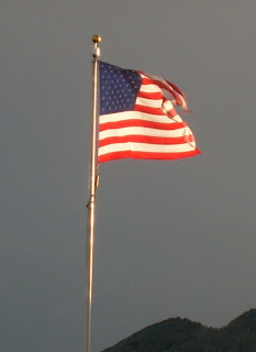
The sky was overcast, the air very chilly. Perfect for putting in a lot of miles. The scheduled distance was 117 miles. As we bicycled past the casinos at 8AM, the flags were flapping in the wind. I remember from my Boy Scout days that that indicates at least 25MPH winds.

The ride today was across Bonneville Salt Flats and then the Great Salt Lake with a couple of mountain ridges thrown in for good measure.

I have a motto in biking, "when you live by the wind you die by the wind". On a day like today with the wind to your back, life is good, you're making great time, you're in your highest gear and you're talking about you're good fortune with your biking buddies. But the wind just needs to shift a bit and the road turns slightly and before you know it, you're in a strong cross wind or even worst; headwinds!!

A couple of times during the day we did get caught by crosswinds, but not as badly as we could have been.
We covered 118 miles today with only three stops. Two at the scheduled rest stops and once a the only gas station that we past for coffee. It's no wonder that with the wind and the flat terrine we arrived at the motel by 1:20PM. Alan and I then pedaled around the hotel a couple of times to round up the mileage to 120 miles.

Today's Stats:

  • 120 Miles
  • 1937 feet climbed
  • Average speed 20.3 MPH

** you really don't believe that we sacrificed an animal for the weather do you???

Tuesday, June 10, 2008

Day 10, Elko to West Wendover

The weather gods smiled on us today. As in past days the air was cool, however it was overcast and the wind was blowing from the west. Since we were heading east, then that was fantastic! The mileage on the route slip was stated to be 107 miles

As we started, the sun was peeking through the clouds sending rays of sun through the early morning light. With the hugh tailwind, the wind speed must have been 25MPH, there wasn't a need for a large pack of rides to provide a wind break. However, Alan, Fred and myself traveled together, rotating the lead position as we again jumped onto I-80.

The time to the first break stop pasted quickly ending with a climb to a summit. We stopped to grab some snacks, but the route sheet showed that there might be coffee in 8 miles. We pulled off I-80 and found an Burger King. Not exactly what we had desired, but better than nothing. More riders piled into after us and soon the place was filled with folks odering burgers.. There wasn't going to be anywhere to get additional meals until we reached our destination. It was only 9:30 in the morning and folks were ordering lunch!


The next breakstop was at the 70 mile point, the the top of another pass. At the top we were again above the altitude of Lake Tahoe. It seems like weeks ago since we were climbing up to Truckee.

During the final third of the ride we took advantage of the down hill and the tail wind to boost the average speed of the ride above 20MPH. On a typical ride, 15 to 17 MPH is pretty good, but we finished today at a average spped of 20.9MPH and 109 Miles!!! It's unlikely that I will ever find that same set of conditions to exceed this distance and speed!!

We had started at 6:30 in the morning a pulled into the hotel at 1:15PM.

Today's Stats:
  • 108.9 Miles
  • 3687 feet climbed
  • average speed 20.9 MPH
  • Max Speed 38.3 MPH
Click for all of todays photos

Click for all of the daily posts

Monday, June 9, 2008

Day 9, Battle Mt. to Elko


Today's ride was scheduled to be 72 miles. Like every other day since the start of the ride, it was a cool clear blue sky at the start. We turned left out the the motel and just keep on traveling.

We were heading into a gentle head wind at the start of the ride and pretty much stayed in a pace line until the first break stop at 26 miles. As you will be able to tell from the photos, the landscape is becoming more and more sparse.

After the break stop we started a long 12 mile climb to
Ennigrant Pass. I gotta pay more attention during the route discussions the evening before each ride, I didn't even know this climb was on the route.

The summit of the pass was over 6000 feet. We haven't been at this this altitude since Lake Tahoe.

The ride down was great, right into the next rest stop. Fred, Alen and myself stopped at a Subways for lunch. The destination of Elko was only 23 miles away.

We were able to catch a tailwind that helped us to speed the trip. I also got my first flat tire on this stretch. A tiny wire had pierced my rear tire. After Fred and I spent 5 minutes trying to pull the wire out of the tire, Fred used his teeth to do what our metal tools couldn't do.

Arriving in town we headed to the Dairy Queen, the first one on this trip, and then on to the motel.

Today's Stats:
  • 75.06 Miles
  • 2240 feet climbed
  • average speed 16.4 MPH
Click for all of todays photos
Click for all of the daily posts

Sunday, June 8, 2008

Day 8, Winnemucca to Battle Mt. NV

Well the trees are now behind us. The weather has been very good to us for the entire trip. Cool enough in the morning that many folks are wearing jackets at the ride start. Sunny and almost cloudless during the day with the highs reaching the high 60's and low 70's.

The concerns expressed about riding on the I-80 have reduced somewhat. In most cases the shoulder of the has been a nice surface to ride on with debris that needs to be avoided. Most of the debris is truck tires that have ripped themselves apart.


I have been pleasantly surprised by the courtesy shown to us by the truck divers. More often than not, an upcoming truck will more into the passing lane to place some distance between us and them

Here Alan demonstrates the proper form of pointing out road debris.

Ride Stats:

Miles: 56.37
Feet Climbed: 1430
Average Speed: 17.1 MPH

All of today's Photos

Day 7, Locklove to Winnemucca, NV


Rolled out of the hotel into the cool clear air this morning. The road out of town was tree lined, perhaps the last set of trees that we will see for a several days.

The route today is mostly Northeast. The winds were coming mainly from the Northeast, so for most of the day we were heading into some pretty stiff headwinds.

During these conditions, it's tough for an individual rider to cover the required distance with out becoming exhausted. Riders tend to "clump" together in packs so that the riders up front can provide a wind break for the following riders. If you have every seen pictures of a bike race, most likely you have seen these packs or peloton.

As the ride goes on the riders will begin to be more confortable riding close together and rotating the positions so that each of the rideres will each have a chance to take a turn creating a wind break for the pack.

Today the first attempt was pretty ragged affair. With some stronger riders in the front and other riders tailing behind.

This kind of rinding is not really effective and can be very dangerous because no rules have been set up and actions of other riders can not be predicted. This went on until the first rest stop.


After a break we departed with Gerard, who is the ride's bike mechanic. Within a couple of minutes at the front of the group, he had all 15 of us riding in a much more organized fashion.

By the second rest stop at 46 miles the group was surprised how much easier it was and much more fun.

Ride Stats:

Miles; 73.7
Feet climbed: 791
Average Speed: 14.4 MPH

Today's Photos

Saturday, June 7, 2008

Day 6, Sparks to Lovelock

The theme for today was "Tailwinds Ho!".


The landscape is beginning to change, from the green mountains of California to the brown dry hills of Nevada. Three miles into the ride we got on to the I-80 heading East. From now until Salt Lake City we will be on the Interstate more often than not. As we entered the interstate we were traveling the same direction as the wind, which was very good because the wind was pretty strong. Several times I was traveling at 25+ miles per hour, a very nice clip indeed.

Perhaps I've failed to mention in my previous post, but America By Bicycle (abbike.com) sets up rest stops along the routes each day. The rest stops has water and snacks to help us through the ride. Today the first rest stop was at 33 miles into the ride. The landscape is getting pretty sparse as the ride goes on. Between the first rest stop and the second rest stop, there is nothing in the way of any highway services. No water, no food, no rest rooms. The second rest stop was located at 66 miles. A bit over 2/3 of today's ride is complete.

Earlier I had spoke about the tail winds. Well as the road twisted and the winds shifted during the day, several times we found ourselves heading into the wind and sometimes uphill. Not a good situation. It makes the day longer and tires you out faster.

We came rolling into town pretty early even with the 90 plus miles we put in.

The motel has wireless, but only in the lobby. It turns out that many folks on the trip are keeping online trip logs similar to this one. Since the lobby is the only place to get a connection, we were all typing away on any surface that we could find. Now this never happened we I first stared keeping travel logs on line in 2002!!


Today's Stats:

  • 92.6 Miles
  • 1469 Feet Gained during the day
  • average speed of 18.1 MPH

Today's Photos

Day 5, Truckee to Sparks, NV


This morning we started out in the chilly mountain air. Headed out of Truckee south to Squaw Valley, the site of the '60 Winter Olympics. After passing by Squaw we jumped on a bike path heading to Lake Tahoe. On the way to Tahoe we also passed a favorite ski resort, Alpine Meadows.

After 10 miles we entered Tahoe City. Tahoe City sits on Lake Tahoe. If Lake Tahoe was a clock, Tahoe City would be at the 11 O'clock position. Todays route is to take us clockwise around the Lake until we reach Incline Village in NV. With the goal of ascending Mount Rose, but first was the goal of stopping for coffee and danish somewhere along the lake's edge. We found a nifty bakery that fit the bill. Then it was off to climb the mountain.

Mount Rose is almost 9,000 feet and Lake Tahoe is about 6,000 feet. The road to the top is over 8 miles and the grade is 6 to 7 percent. This is the big climb for the day. With cool air, the only difficulty was the distance, but within 90 minutes or so, I was at the top, were there still was some snow.

The decent was trememdous!! Almost 17 miles of downhill at the same grade as the uphill side. We rolled into Sparks early enough that it was still lunch time. We had stopped to have a sandwich and a drink before finishing the ride at the motel.

Ride Data:

Miles: 66.50
Alt climbed: 3821 ft.

daily photos
All Log entries

Friday, June 6, 2008

Day 4, Alburn to Truckee


The theme for today must have been; climb we must!!!

The day was planned on being pretty long, 74 according to the route directions, but the hard part would be the elevation gain. We started out at about 6:30 and started climbing. Most of the roads we used were frontage roads to I-80.

The maximun a typical road will climb is about 6%. The roads we were on sometimes exceeded 12%!! When you are pushing you bike up hill every degree counts!!

I guess I made it a bit harder on myself by making a wrong turn. I went speeding down a really fun hill for 3 miles before I discovered my error, had to slog uphill for the 3 miles to rejoin the course.

We needed to eventually leave the frontage roads and get on the Interstate. Saying that riding next to tractor-trailers is exciting would be an understatement.

After what seemed to be forever, we finally made it to Truckee. The final numbers were:

Miles: 81
feet climbed: 8871

We earned a good night rest

View Todays Photos
View all Log entries

Day 3, Sacramento to Alburn


It must be nice to live in the capital, a wonderful bike trail was right outside our motel. After a breakfast at Lyons, we jumped on to the path. For 33 miles we followed the winding path all the way to Folsom Lake. We even stopped to take photos of the prison.

The lunch was by the lake and soon we were off to Alburn, only another 17 miles to go.

The real treat was Alburn itself. I had coffee with a bunch of the other riders when we got there, but decided to explore the town a bit. Alburn is a old mining community with two museums. On a tip, I was directed to see the Amzons. A local dentist has created several large statues around town, but the most unsual are located in the parking lot of his office.


Another fine example of why you need to explore each town. Who would have guessed that this little town had ssuch fine art!!


Daily Stats:

  • 59.26 Miles
  • 2965 Feet Gained

today's photos
all of the trip logs

Thursday, June 5, 2008

Day 2, Fairfield to Sacramento

Left, Right, Left, Right

The early part of the day was using rural farm roads to work our way to Davis. The planned route was pretty short, only 57.6 miles. Not too long if you have all day to do it.

Early breakfast then off. Down couple miles turn left, couple more miles turn right until we were at Davis. The pace was pretty fast so we got there pretty early. We stopped for coffee before heading off to find Redrum Burgers. We had it on pretty good authority that the burgers were not to be missed.

After lunch we headed off to the for the final leg of the trip, Sacramento. The distance was only 15 more miles to the Motel near Old Sac, most of it on a bike path that ran along the I-80. We stopped for shakes in old town. I headed toward the capitial to explore before heading off to the Motel that was near the river.

Daily Stats
  • Miles today: 57.72
  • Elevation Gained: 372 feet

Today's Photos
all of the trip logs